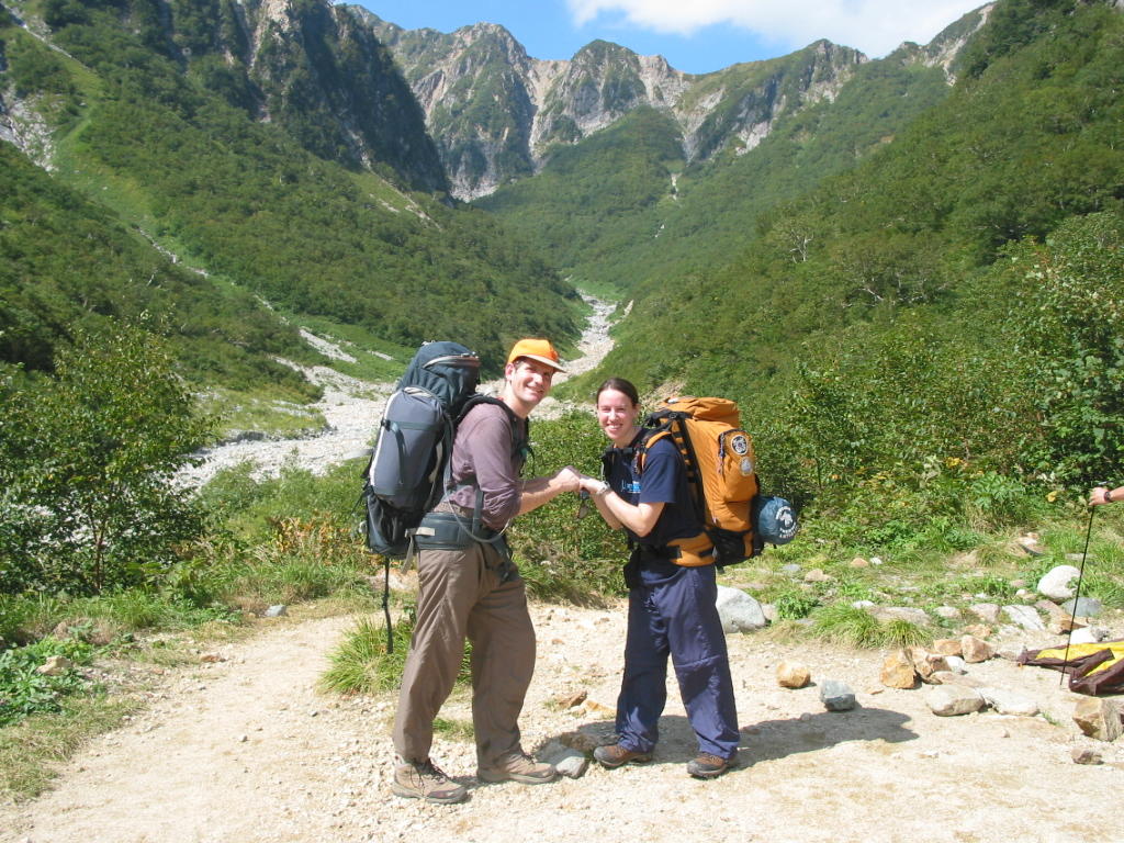
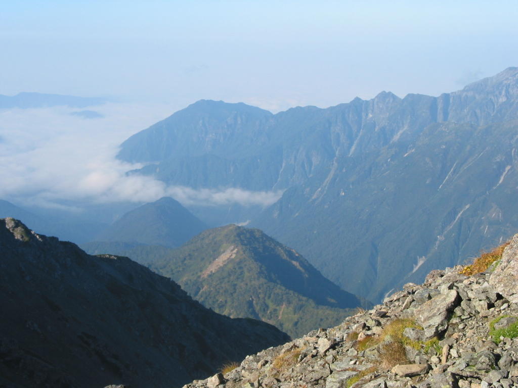
 All right! Now that my website is back in working order, I can finally share my trip with you!! We had an awesome trip- we practiced a lot of flexibilty but now that we're back on the ground, I don't think either of us regret it. Day 1: We arrived at the Kamikochi Bus Terminal after an overnight trip from Shinjuku around 6:00 am. After pit stops to brush teeth, pee, and generally wake up, we searched for water, applied sunscreen, checked the map and headed for the trail. Both the beauty and the evil of the trail for Yarigatake (our first peak of trip as planned) is that for about 3/4 of the day you don't go up at all. It was quite unnerving to hit the first lodge after three hours of hiking and not have made any gains in elevation. The sky was blue and we were "enjoying" (while rolling our eyes) hiking with enough other hikers to make us feel like we were in a regular road race. The mob hike required a steady pace and the ability to pass on the right while remaining in control of a wide load (i.e. backpack filled with enough food & equipment for three days). My pack was heavier than I was used to, and when we hit lunch I was a hurting puppy. The bad news is that we still hadn't started going up! We feasted on tuna sandwiches at the Yarisawa Lodge, shifted weight around, and refreshed our water supply. As we headed out, we got a peak at the top of Yari through a telescope set up near the Lodge... that's how far it still was (...we'd already been hiking for 6 hours remember).
 A bit further up the trail we paused our pace for a breather and then we really had to dig in and start heading UP.
 This section required a lot more breaks and a lot more trail mix. We ran into a threesome of JETs from Wakayama (2 Americans and a Canadian) and continued to play tag up the mountian. After another couple of hours we finally round the corner and saw the peak. It was WAY above our heads still, but just being able to see it was a relief. Now there was a goal, at least. There was also a bit less oxygen... and we'd been hiking for 9 hours with heavy, heavy packs. I started to seriously doubt my interest in continuing on the rest of our trip. After another 30 minutes I seriously doubted whether I could make it to the top. Another 10 slogging steps and a breather. I told Tom that this was The Worst Thing I'd Ever Done. I didn't have the energy to explain that I meant worst physically.. not worst EVER. But it was B-A-D. I started getting a lump in my throat trying not to cry. I was out of water, too tired to stop for food, and getting increasingly more annoyed by the spray painted numbers showing the remaining meters left to the lodge. I'm sure they were intended as encouraging, but everytime I thought I'd made progress I'd see another painted rock "500 more $#@$ing meters!". URGH.
We reached the lodge at 4:30 PM and as quickly as we could get our aching bodies inside, paid for the tentsite. We followed the trail along the ridge and over some outcroppings to the tent area- more spray painted rocks indicating the tiny spaces for each tent. When we found ours, we stared in disbelief. It was smaller than my bathroom and more triangle then square. I did an about face and headed back to the lodge while Tom dumped our stuff in a larger square. The tent man was nice enough to upgrade us to a larger site, though Tom had already set up so we had to chance picking up the tent to move it.. risking it being sucked up into the strong mountain winds. Safely set up with rocks on the corners and packs inside to keep the tent from blowing, we headed back up past the lodge to the peak. Yeah... we weren't done yet. Somewhat encouraged by the lighter load (I took nothing but my hat, gloves, and jacket... Tom had a camera, those shots later), we hurried to the peak. The top of Yarigatake is famously steep, sometimes refered to as Japan's Materhorn. I'd worried a bit about this final section of the "trail", but after all the straight, hard slogging of the day the scramble up the chains, boulders and ladders of the peak was quite fun. And then there we were: at The Top. It was sunset and there was a small group of Brits enjoying the top with us, but the only thing I really noticed was that we were Finally Done. I smiled pretty for the camera, shared some jokes with the others and then headed for the ladders... to go down!! Back in the lodge, Tom and I shared a very well deserved $10 mug of draft beer (delivered to the top via helicopter no doubt). Exhaustion set in and we both inched closer and closer to giving up the next day's trek. And then... there it was. We both wanted to go back down. Sigh. Relief. The facts on the table included: we were tired and hurting after 10 hours plus of hiking, the hut had no drinking water except in $2 500 ml bottles that we'd then have to carry, there was a typhoon heading towards Japan, the next two days of hiking would be as tough or tougher than what we'd just done. Screw it, we said, and headed to the tent for curry dinner. I was out cold before Tom finished getting in his sleeping bag.
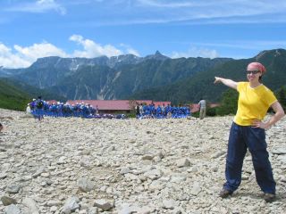
 Day 2: We slept in (well, 7:00 anyhow) and woke up to crystal clear skies and amazing, thanksgiving inspiring views. So much for the typhoon! We took our time with breakfast and packing. The Tom decided to climb the peak again. (expand the peak pic. and look for the little man in yellow) I happily volunteered to be photographer, tea drinker, and sit-on-my-ass-while-you go-right-ahead-er. And was just fine with that.
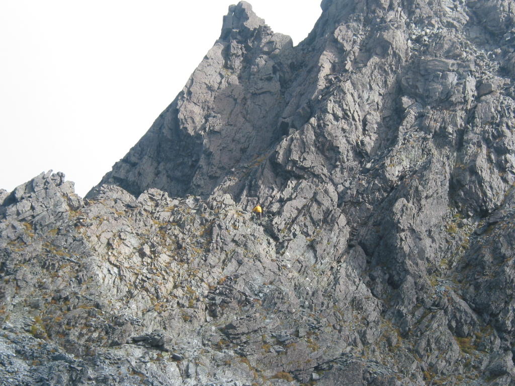
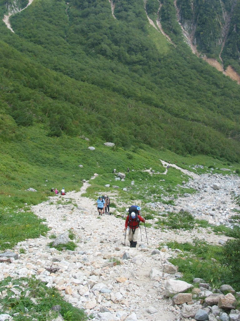
Then we headed down. And down, and down, and down. Even though we knew distinctly how long the trip up had been, we were shocked again at how long it took us to get down. The trail back to Kamikochi was a full 17k (or 22k depending on which sign you looked at). We were headed for Yoko sanso again, and it took most of the day to get there; 9:30am to 4:30pm. We'd given ourselves a relaxing morning but were still somewhat taken aback by the hikers arriving at the peak by 9:00am, already finished hiking for the day. There's definitely a different time schedule up there in the mountains. One guy was already pulling up his beer! The hike down, though long, was uneventful. Before we stopped for lunch, the clouds rolled in and we bid the peak farewell. We set up our tent back down along the river near Yoko sanso (where we'd stopped first the day before) and got in just as it started to mist. After chilling our tender feet in the frigid river, we celebrated the hike with mac & cheese (thanks Grandma & Grandpa!) and some fig wine that Tom had lugged from Germany (and up the mountain!). Then by 8:00pm we were out cold again.
Day 3: The next day we only had to get back to Kamikochi so we had another slow morning relaxing over 10grain cereal and drinking our hot cocoa in the sun. Yes! Sun, again! With the exception of the previous nights misty rain, we had simply amazing weather. The bright, clear morning refreshed and energized us for the trip back to Kamikochi. We made it in about 2 and a half hours. With our extra time we headed to the bath and made it just before it closed. I've never been so thankful for hot water!
 My legs were just shot though, it was all I could do to shuffle over to the bus terminal and sit down and wait with my cold beer. It was a great trip though, and Tom and I are already back into the magazines looking for our next mission. Cheers to fall hiking in Japan!! P.S. The rest of my pictures are here (labeled and everything). More to come when I get Tom's.
posted by jaclyn @ 9/28/2005
0 comments
![]()